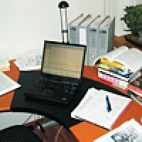
The idea of the Zurich City Guide developed in the Global Information Systems (GlobIS)
research group at ETH Zurich was to build a mobile application based on paper documents, a
pervasive medium which is very portable and therefore well suited to mobile tourism. To
gain first experiences in the area of tourist applications, we decided to focus on paper
maps, only one of the many paper documents used by tourists, and investigate how they could be
enhanced by using our interactive paper platform. Since different groups of tourists may have
different interests, a goal was to develop a personalisable city map which could provide
different information based on the very same paper map.
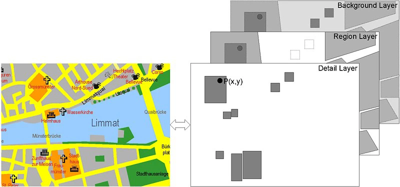
Therefore, a city map of Zurich was augmented with various links on three different information
layers, a Background layer, a Region layer and a Detail layer, to provide supplementary
tourist information about Zurich.
Fig. 1: Zurich map
A single rectangular active area, covering the entire map and linking to some general
information about Zurich, has been defined on the Background layer. By covering the
whole map with this active area on the Background layer, we can guarantee that,
in case no other information is linked to a user’s selection, at least information
associated with that active area is returned. The active area on the Background layer
is linked to some general information about Zurich, which is always accessed in
the case where no detailed information is available. The second layer, the
Region layer, contains links to information about larger regions of the city
whereas the topmost layer, the Detail layer, defines link anchors for information
about specific buildings or places.
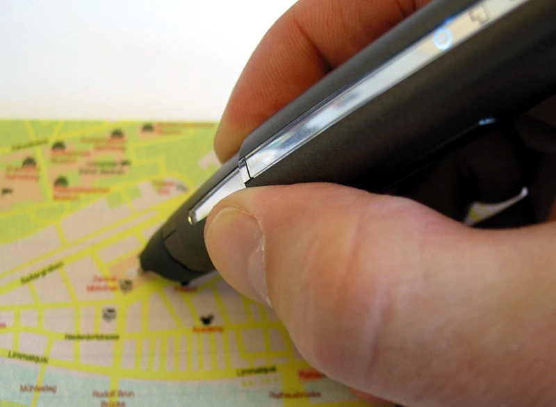
What happens if a user selects a position P(x,y) with the digital pen as shown in
Fig. 2. P lies within three different active areas defined on each of the three
layers but the system will only resolve the link bound to the shape on the topmost layer,
in our case the detail layer, and therefore returns the most specific information which
happens to be some data about the Grossmünster cathedral.
Fig. 2: Background, region and detail layers
To personalise a paper map, specific layers may be activated and deactivated
based on a user’s preferences. This activation and deactivation of layers enables us
to deliver context-dependent annotations based on the current set of active layers.
For example, by defining different layers for different activities/interests,
such as shopping, eating etc., we can dynamically customise the city map by
activating or deactivating some of these layers. Furthermore, by using a
"zoom in/out" functionality, repeated selection of the same map area can be
used to deactivate the uppermost layers making accessible information linked
to active areas defined on lower layers.
Mobile users are, not only limited in terms of the available computing power,
but also in the amount of attention they are willing to pay to any digital
devices. Most tourists prefer to visit a city with open eyes instead of
focusing their eyes on the screen of a Pocket Computer all the time.
For the Zurich City Guide, we therefore started to experiment with
non-visual feedback in the form of spoken information generated based on
XIMA's voice output facilities. This enables a user to interact with the
city map by the means of both paper and voice recognition for input and
voice feedback as an output channel. While the Zurich City Guide was
limited to paper maps only, it helped in investigating the general
field of information technologies and tourism and provided a foundation
for EdFest, a more complex tourism application that was developed for
the Edinburgh festivals.
Related Publications
2025
Pen-based Interaction,
Beat Signer,
Handbook of Human Computer Interaction, Major Reference Work, Springer Nature, 2025